Purchase this map at higher resolution and without the watermark for only $1
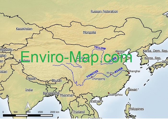
The Yangtze River is the longest river in Asia and the third longest in the world behind the Nile and the Amazon river. It is estimated to be about 6300 km or 3915 miles long. It originates from a glacier located on the eastern side of the Plateau of Tibet.
The Yangtze is heavily polluted due to untreated wastewater discharged into the river. Wildlife like the local population of dolphins has become threatened. Moreover the quality of drinking water for the population living along the river has become degraded.
The Yellow River is the second longest river in China and is approximately 5,464 kilometers or 3,398 miles in length. It has been dubbed the ‘cradle of Chinese civilization’ as it is believed that China’s civilization originated from here.
It also has been nicknamed ‘China’s pride’ as well as ‘China’s sorrow’ as the river is prone to severe floods due to its elevated river bed. The name the ‘Yellow River’ comes from the ochre-yellow color of the river in the lower course of the year. This color is caused by the amount of sediment that is suspended in the waters.
The Yellow River is very polluted mainly due to discharge from industry and household wastewater. Currently it has been estimated that one third of the river is unsuable even for industrial or agricultural use.
Made with Natural Earth. Free vector and raster map data @ naturalearthdata.com.