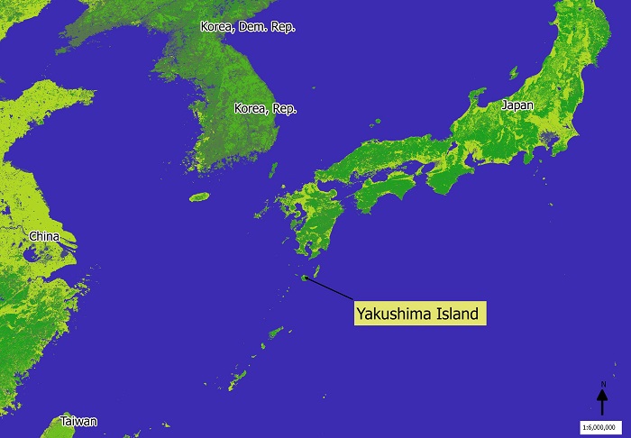
Here is a map of Yakushima Island. It is a natural World Heritage Site since 1993. It is famous for its ancient trees known as Sugi in Japanese, often called Japanese cedar trees. This species of tree is endemic to Japan and some trees are said to be thousands of years old.
It is also a habitat for deer, macaque monkeys and migratory sea turtles and was the inspiration for Hayao Miyazaki’s animation Princess Mononoke. There is mountainous terrain on the island with the highest point reaching 1,935 meters above sea level. It is the southern most part of Japan where snow falls in the mountains. The ocean temperature is never under 19 degrees Celsius and frequent rainfall causes humid conditions in spring and summer.
My daughter is a JET teacher on Yakushima island. I have not heard from her since the earthquake and
would appreciate knowing any information about whether the island was hit by the tsunami. Any information would be great!
Hello,
I’d say communication with people in Japan has been difficult due to the network (especially Mobile) being overloaded but keep trying.
I hope you can get in touch with your daughter soon.