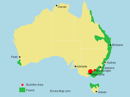
The map above shows the approximate areas in Victoria affected by bushfire in February 2009. Authorities believe the fires were lit deliberately and are currently searching for the arsonists. The death toll in Victoria is expected to run into the hundreds. The major areas affected are located around Melbourne especially the towns of Marysville, Buxton and Narbethong. Residents have lost their houses, livestock and their livelhoods.
Sehr wertvolle Informationen! Empfehlen!
I REALLY liked your post and blog! It took me a little bit to find your site…but I book marked it. Would you mind if I but a link back to my site?
Good post.