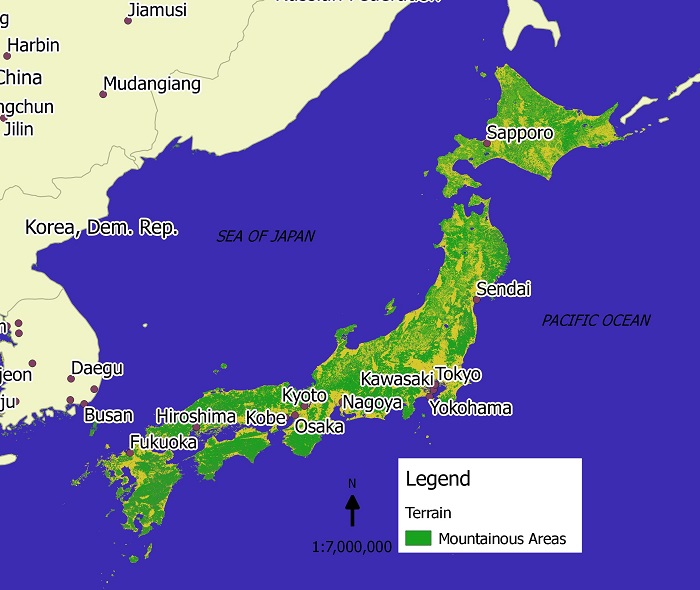
Here’s a map of Japan that I created. It shows the mountainous area of the island nation and as indicated on the map the majority of the land is mountainous and therefore difficult for residential, industrial or agricultural uses.
It is estimated to be about 145,883 square miles in size with 70 to 80% being mountainous. The mountainous areas are usually covered in forest.
Difficulties in traveling across the country have been overcome by technological advances, as Japan is famous for its long railway tunnels that go under the hills and mountains.
Because of Japan’s location at the intersection of three tectonic plates, earthquakes are commonplace. In addition to this, 10% of the world’s active vocanos are found in Japan. The most famous of Japan’s volcanos is mount Fuji, located between Tokyo and Shizuoka, which is still considered active. In the cooler seasons, steam can be seen bellowing out of the top of Mount Fuji.

dosnt tell me every were dumass