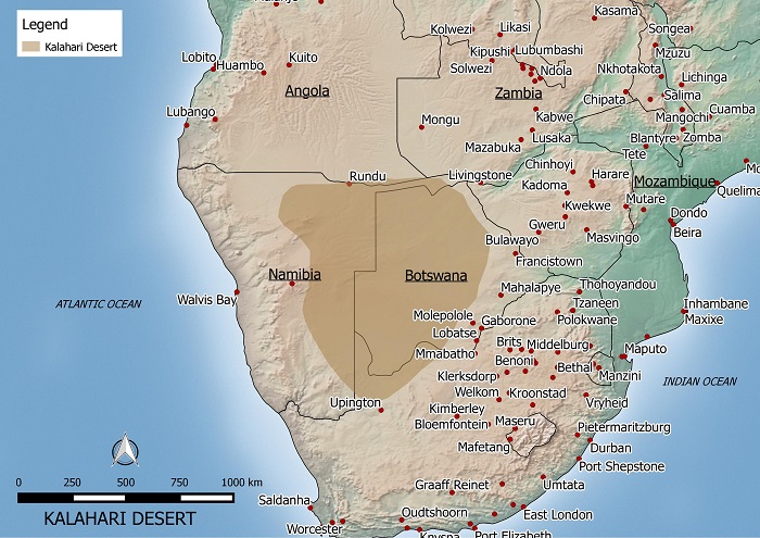
This is a map of the Kalahari desert that I made. If you’d like to use it on your site, please let me know by emailing me @ kaotic_ken(at)yahoo.com.
The Karahari desert is located in Botswana and parts of South Africa and Namibia. The total area is estimated to be about 260,000 sq km large and is part of a larger Kalahari Basin. The desert is generally flat with an elevation of about 1000 meters above sea level.
The Kalahari is semi-arid with droughts occuring frequently. The regions receives an average of 200 milimeters of precipitation a year mainly between October and May. The temperature can reach as high as 45 degrees celcius in summer and as low as below freezing in winter.
Made with Natural Earth. Free vector and raster map data @ naturalearthdata.com.
This is a great site that you have here. The Internet needs sites like yours that preach to others about the importance of going green. I have a site myself where anyone can express their opinion towards controversial issues. Recently, we came up with a debate topic about going green and I wanted to inform you about it:
http://www.debateitout.com/should-corporations-be-required-to-go-green.html
Take care. Keep up the good work. Maybe we can do a link exchange.
Sincerely,
Jason