Purchase an image of this map at higher resolution for only $2.
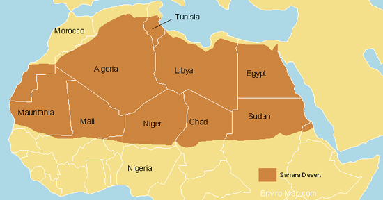
Here is a map of the Sahara desert that I designed.
The Sahara desert is estimated to be about 9,000,000 square kilometers. It is bigger than the total area of Australia and almost as large as continental United States.
It encompasses Algeria, Chad, Egypt, Libya, Mali, Mauritania, Morocco, Niger, Western Sahara, Sudan and Tunisia.
There has been speculation that the Sahara is expanding and encroaching on the Sub-Saharan region however these claims have not been proven.
Vegetation measurements taken from satellite images showed that over 11 years the Sahara ebbs and flows much like a tide and hasn’t been continually expanding.
Source:
http://findarticles.com/p/articles/mi_m1200/is_n3_v140/ai_11127602